Our first meeting / presentation at The Wells House features our longtime friend, Dr. Karl Lillquist.
After many years at the Wenatchee Valley Museum & Cultural Center, the Wenatchee Valley Erratics Chapter officially closed its
longtime headquarters there on May 18 as the Museum begins an extensive renovation and expansion project.
The Missoula Ice Age Floods are a fascinating and important part of geological history.
There’s an initiative dedicated to educating the public about them, the Ice Age Floods Institute (IAFI).
The Wenatchee Valley Erratics is the
North Central Washington Chapter of the IAFI.
This Ice Age Floods animation (below) is the result of years of scientific research, collaboration, and careful design. Its goal is simple but ambitious: to help people see how repeated, massive floods once reshaped the Pacific Northwest—and how those processes connect the landscapes we can still visit today.
Click below to see the full story on the NPS website.
“Imagine the greatest floods on earth crashing across and sculpting the lands of the northwestern United States. This incredible true story is recorded in the rock and sediment of Montana, Idaho, Washington and Oregon. You can explore the geologic clues and special landscapes made by the Ice Age Floods at sites along the Ice Age Floods National Geologic Trail and glimpse a visualization of these events by watching this animated video.” (quote from NPS website)
Video above created by NPS and can be viewed here on the NPS website.
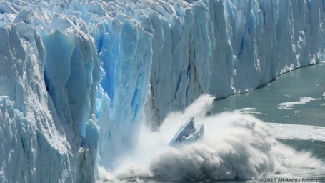
Try to imagine the magnitude and power of Glacial Lake Missoula Ice Dams repeatedly breaking, perhaps 100s of times…
Here is what one of those breaks could have possibly looked like*.
*This simulation was created by the WV Erratics webmaster, Ron Lewis, and is designed to peak interest in the Ice Age Floods.
Learn the language geologists use when describing specific times in earth’s history.
Geologic Time Scale – Click Here
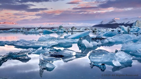
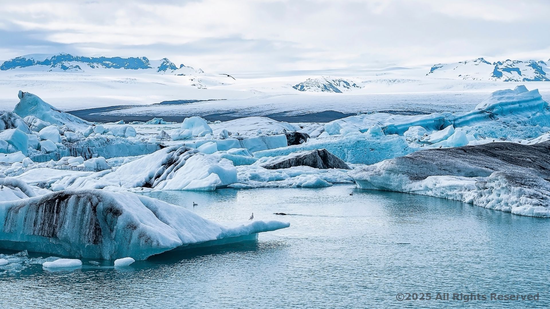
The ice sheets that once covered much of the earth shaped so much of the landscape we see today, and so much of what we can’t see anymore.
Beneath all that ice, the land would have been incredibly different—sculpted, molded, and sometimes even hidden from view for thousands of years.
When the mile-thick glaciers advanced, they didn’t just sit there.
They ground down mountains, carved out valleys, and left behind features like fjords, drumlins, and moraines.
But once they receded, the land was often reshaped in ways that left us with only traces, like the boulders left behind or the freshwater lakes formed in the depressions.
It’s fascinating to think about the life under that ice too—what ecosystems might have thrived before being buried.
And as the ice melted, the land began to breathe again, revealing more and more of its history as we dig deeper.
What’s been most intriguing to you
about the landscapes shaped by glaciers or ice?
JOIN the Wenatchee Valley Erratics today,… you’ll be glad you did!
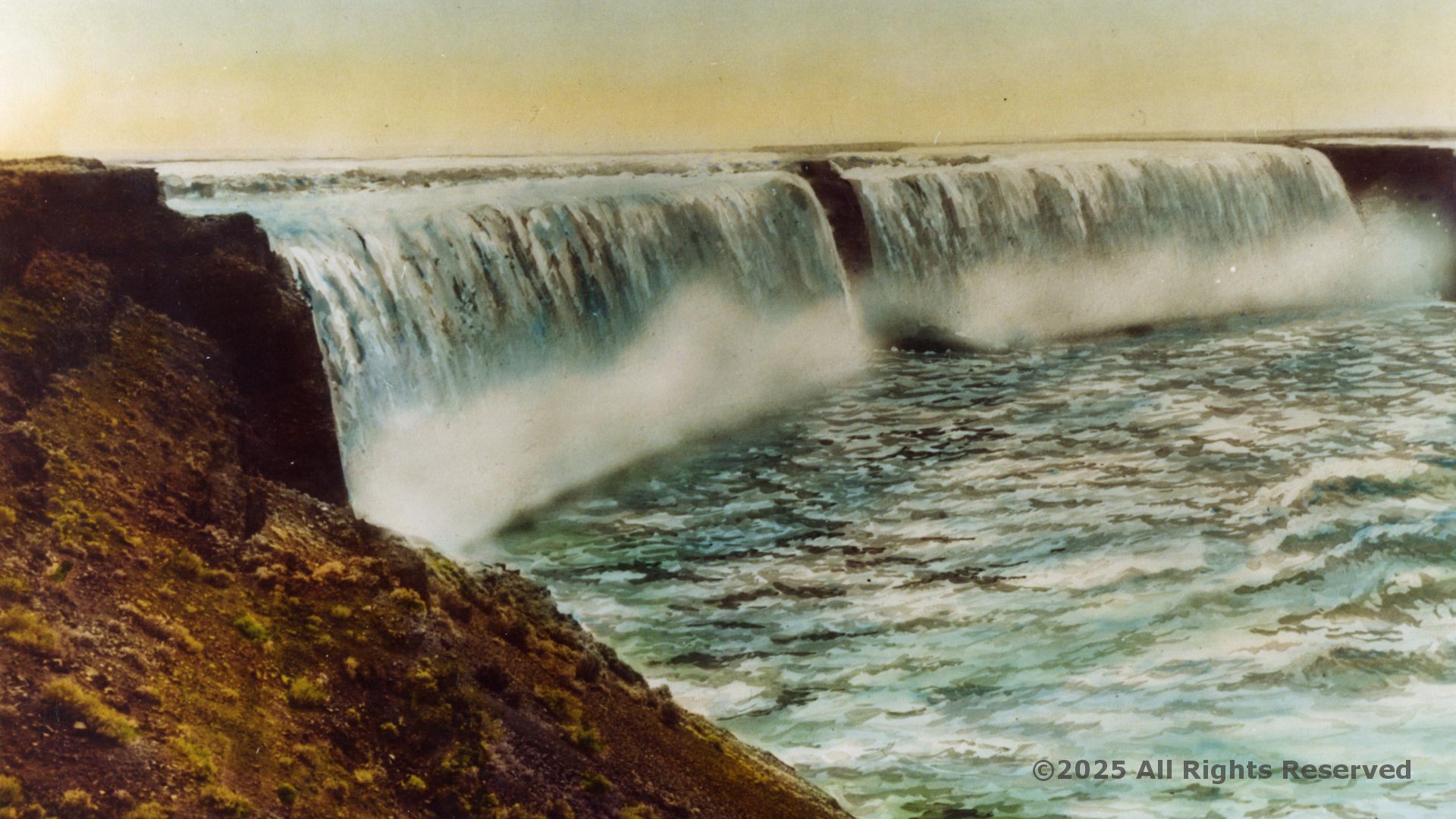
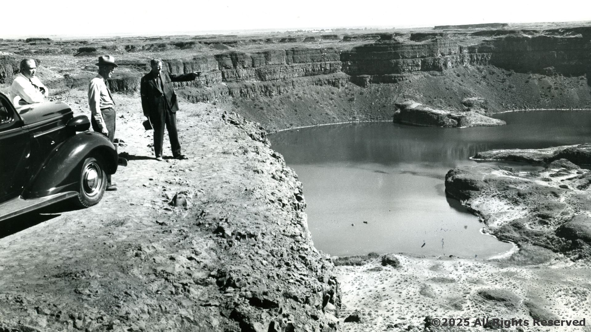
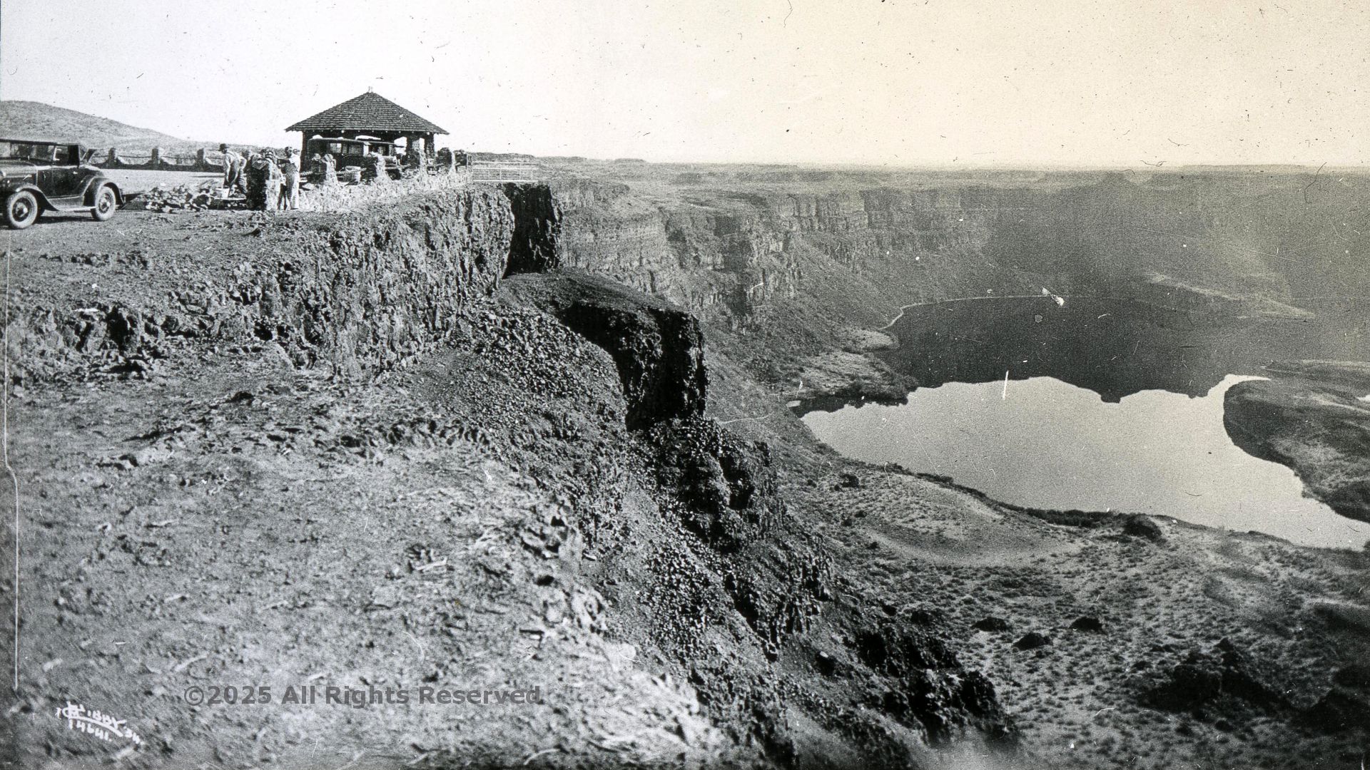
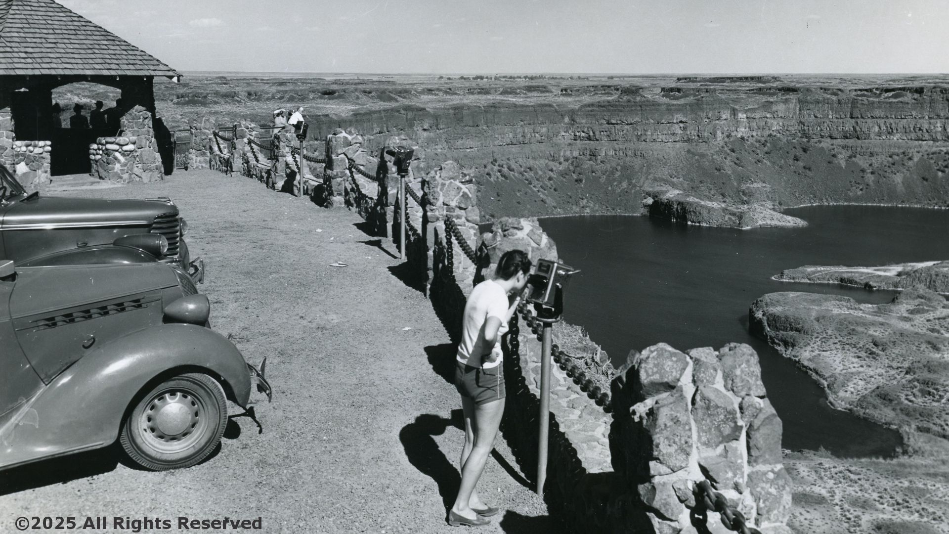
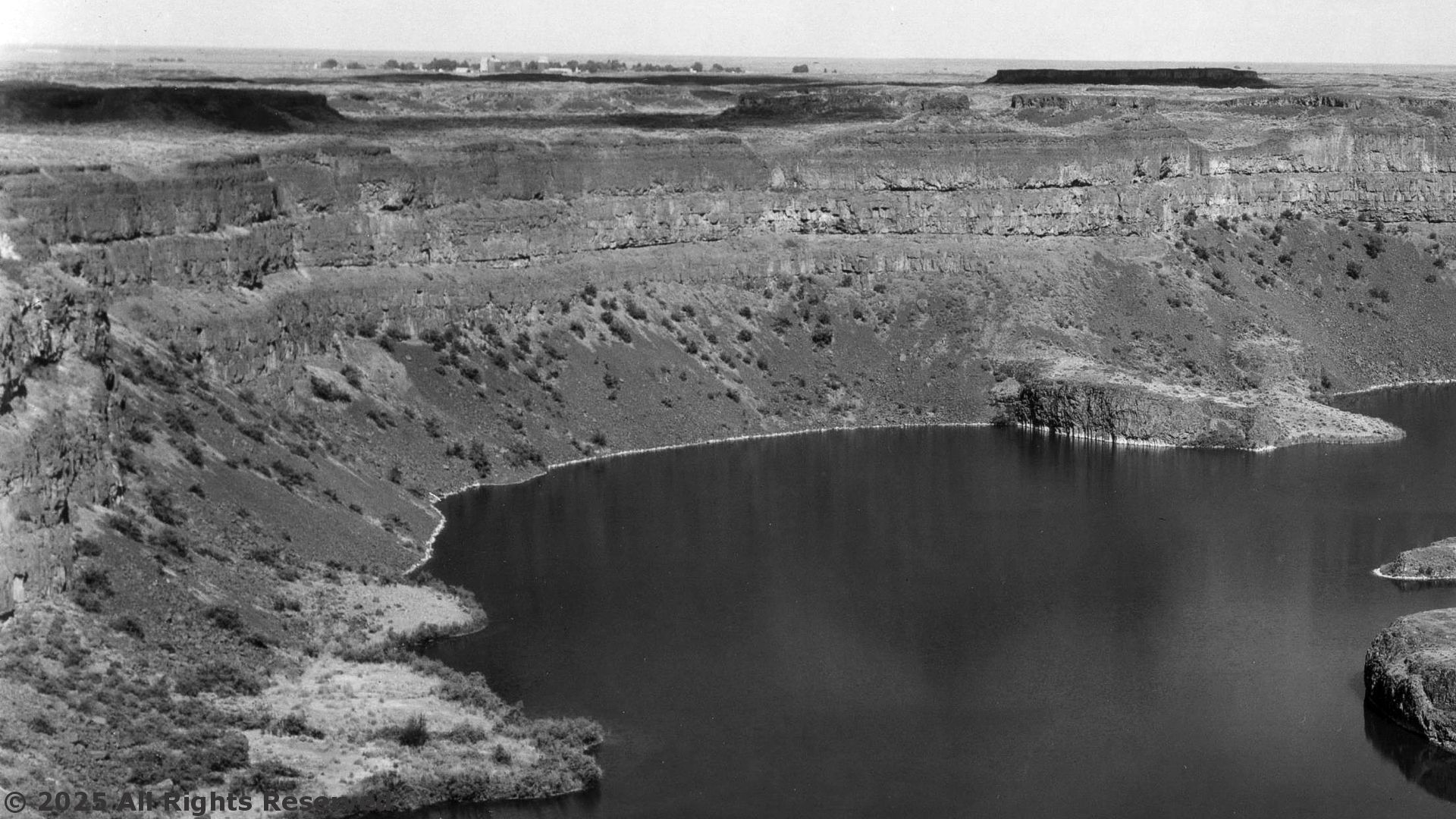
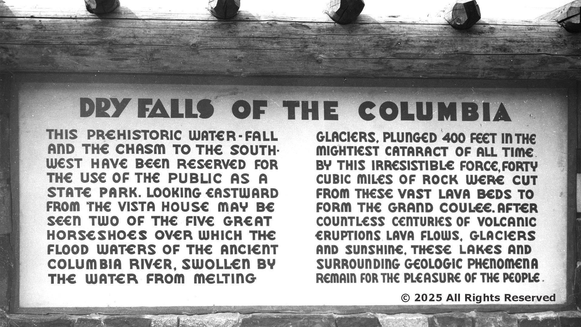
Reconstructed photograph showing what Dry Falls might have looked like with water flowing.
Asahel Curtis
ca 1920 1930
Humans break time into familiar pieces—years, months, weeks, days—to make sense of our lives.
Geologists do something similar, but on a far grander scale!
To track Earth’s 4.6-billion-year history, they built a powerful tool: the Geologic Time Scale.
Think of it as Earth’s “calendar,” divided into chapters marked by dramatic turning points—towering mountain ranges rising, continents drifting, oceans opening, and entire groups of life appearing or vanishing.
This time scale didn’t spring from the mind of one scientist or a single committee. Instead, it slowly took shape as generations of geologists compared rock layers, fossils, and global events—often working continents apart, long before they could communicate quickly. Their collective discoveries gradually revealed a coherent timeline of Earth’s past.
Today, international scientific committees formally define and refine each segment of this timeline. The result is a global framework that lets us understand not only when things happened in Earth’s history, but how life and the planet have changed together through deep time.
The USGS Geologic Time Scale is shown below.
Most recent time is on top, oldest on the bottom.
(MYA = Millions of Years Ago):
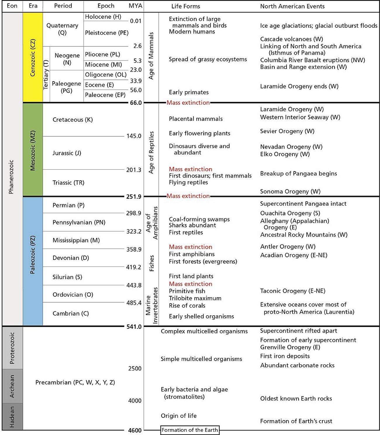
The Geologic Time Scale is Earth’s master timeline—a structured map of 4.6 billion years of change, recording when continents collided, oceans opened, mountains rose, and life evolved from simple cells to complex ecosystems. For North America and the Northern Cordillera of Alaska (SCAK, SEAK, NAK, CAK), this timeline also highlights the major tectonic pulses and biological milestones that shaped the region.
The time scale begins with the Precambrian (shown in GRI GIS data as PC, X, Y, or Z), which spans three vast eons:
Hadean (4600–4000 MYA) – Earth forms, its crust solidifies, and the earliest hints of life emerge.
Archean (4000–2500 MYA) – The oldest known rocks appear; bacteria and algae thrive, forming stromatolites.
Proterozoic (2500–541 MYA) – Simple multicellular organisms evolve, and Alaska’s oldest rocks (the Kanektok Metamorphic Complex) take shape. By the end of the Proterozoic, complex multicellular life begins to flourish.
Next comes the Phanerozoic Eon (541 MYA–present)—the eon of abundant, visible life—divided into three eras: the Paleozoic, Mesozoic, and Cenozoic.
A time of marine expansion, evolutionary breakthroughs, and continental assembly. Its seven periods include:
Cambrian (C) – Early shelled organisms appear, coral groups rise, and SE Alaska experiences the Wales Orogeny.
Ordovician (O) – Trilobites peak, primitive fish emerge, followed by a major extinction marking the transition into the Silurian.
Silurian (S) – The first land plants take hold; SE Alaska is reshaped by the Kakas Orogeny.
Devonian (D) – Forests spread, amphibians appear, and volcanism surges in the Yukon–Tanana and Brooks Range.
Mississippian (M) – The ancestral Rocky Mountains rise, and the first reptiles evolve.
Pennsylvanian (PN) – Coal swamps dominate; Pangaea and the Tethys Ocean begin to form.
Permian (P) – Ends with the largest mass extinction in Earth’s history.
The age of reptiles, drifting continents, and dramatic tectonics. It includes:
Triassic (Tr) – The first dinosaurs and mammals emerge; flying reptiles appear; Pangaea begins to break apart.
Jurassic (J) – Dinosaur diversity increases; the Talkeetna arc develops; the Brookian Orogeny begins.
Cretaceous (K) – Flowering plants spread, the Canada Basin opens, Arctic Alaska rotates, and major plutonism shapes Alaska’s crust. The era ends with the mass extinction that wiped out the dinosaurs.
The age of mammals, modern ecosystems, and ongoing tectonism. Divided into:
Paleogene (PG)
Paleocene (EP) – Early primates appear.
Eocene (E) – Slab-window subduction affects south-central Alaska.
Oligocene (OL) – Bering Sea volcanism begins; the Alaska Range begins to rise.
Neogene (N)
Miocene (MI) – Grassy ecosystems expand.
Pliocene (PL) – Grasses continue to spread and modern landscapes take shape.
Quaternary (Q)
Pleistocene (PE) – Modern humans evolve; repeated ice ages sculpt the northern landscape; large mammals go extinct at the end of the epoch.
Holocene (H; present) – The most recent interglacial period, beginning as the last ice age ends.